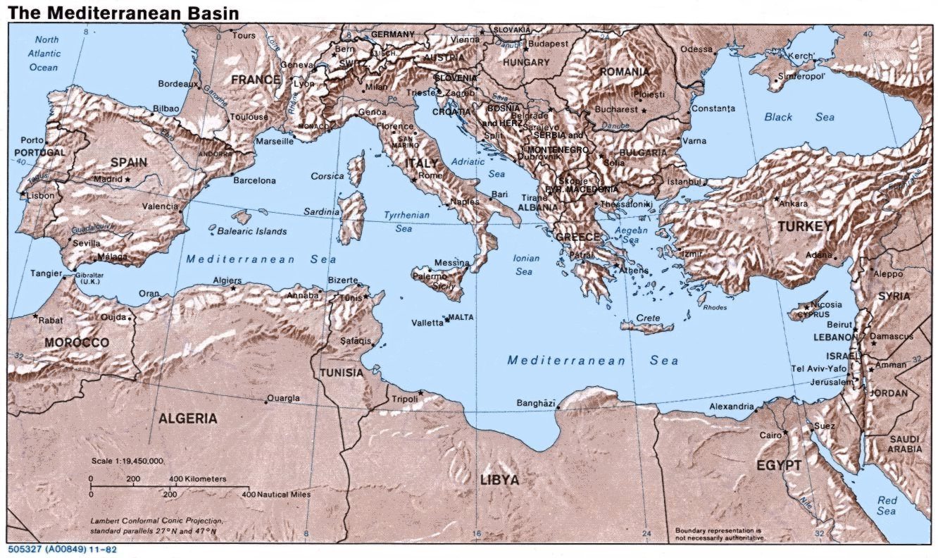
File:Mediterranean Relief.jpg
Size of this preview: 800 × 476 pixels. Other resolution: 1,332 × 792 pixels.
Original file (1,332 × 792 pixels, file size: 274 KB, MIME type: image/jpeg)
The original map was created in 1982 by the Central Intelligence Agency ([1], specifically [2]). This version was produced by Wikipedia User:Joy, who originally uploaded it to the English Wikipedia:
![[2]](http://www.lib.utexas.edu/maps/europe/mediterranean_rel82.jpg)
- 23:46, 28 Sep 2004 . . w:User:Joy (343433 bytes) (an update after 22 years :) added borders and names for the ex-yu republics (si,hr,ba,cs,mk); corrected names for de,sk; dropped su name but didn't bother drawing the md/uk/ru borders or names because they're not near the topic at hand, and it's tiresome)
File history
Click on a date/time to view the file as it appeared at that time.
| Date/Time | Thumbnail | Dimensions | User | Comment | |
|---|---|---|---|---|---|
| current | 05:14, 15 January 2007 | | 1,332 × 792 (274 KB) | Jcpeterson (talk | contribs) | The original map was created in 1982 by the Central Intelligence Agency ([http://www.lib.utexas.edu/maps/europe.html], specifically [http://www.lib.utexas.edu/maps/europe/mediterranean_rel82.jpg]). This version was produced by w:User:Joy, who origina |
You cannot overwrite this file.
File usage
There are no pages that use this file.